Underground Tombs of Section A
There is a section of the cemetery that looks, even at first glance, quite different from the others. Large monuments are dispersed throughout the area, and many are bordered by ground-level slabs or corners. If you were to stand at the easternmost end of the area and look west, you could see small markers scattered between the lines of 4 rows of large markers.
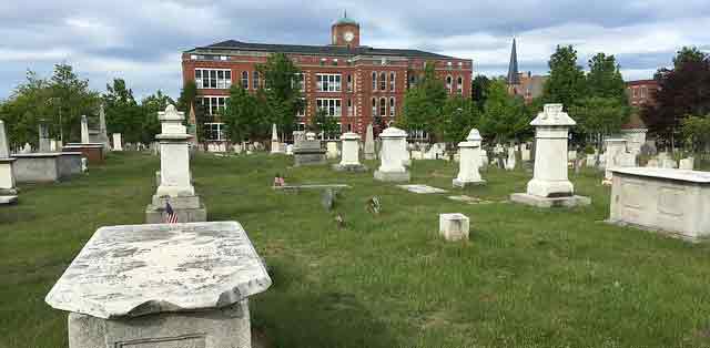
This is the tomb area of Section A. It consists of 86 underground rooms, each with a hidden stairway entry, built to hold up to 30 coffins each. This allowed someone to purchase a space where they and the remains of their future deceased family members could be stored together for eternity. The construction of these tombs began in 1795 and continued for the next several decades—perhaps they were built as they were sold. The city made other changes that year including an ordinance that bodies must be interred in the next available open plot—there would be no saving space for relatives anymore. This likely gave families another good reason to purchase a brand new underground tomb.
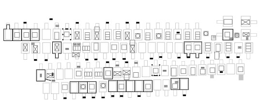
Section A Tombs Area Map Detail (Section A map with key (PDF))
Underground Rooms
The rooms in the 4 rows are drawn on the 1890 cemetery map as sharing side walls. In the recent past, when a tomb has been opened by the city, inspection has revealed that some ceilings are vaulted brick and some are granite slab. Walls or wall bases are made of rock similar to that used on the retaining wall on Federal Street. Some walls are also brick. The room sizes are thought to average about 12' x 6' x 6' 1 and have brick floors. Each tomb was meant to hold a number of human remains—friends or relatives of the owner—but at least one is thought to be empty.
Tombstones
Tombs must have been purchased and attributed to certain owner names. As of the 86 known underground tombs in the area, 33 of them have what we consider to be a visible “owner’s marker”2 or tombstone marking the top of the underground stairway. Of the tombstones that still remain, there are 17 marble, 14 sandstone, 1 slate, and 1 granite. Of those that can be read, 14 are inscribed with initials, a last name, and a year.
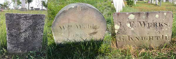
Tombstones for E. Shields & W. Adie, Wm. Webb, JF Weeks
Markers
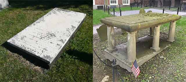
Owners adorned their above-ground plots with unique and personalized stone markers. The collection that remains includes boxes (there are 14), obelisks (there are 6), and marble monuments (5 include granite). There is even one boulder of uncut granite marking a low spot in the ground that you might not realize belonged to the Tewksburys.
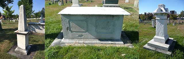
Some of the large marble slabs or ledger stones (there are 14) with a ground-level base are likely all that’s left of what we can assume were table-top markers. Originally, a ledger stone would have been supported with 4 to 6 stone columns. The legs now gone, the ledgers rest on top of the base layer that might be sandstone, granite, or brick.
Note that there are several military stones dispersed throughout the tombs as well. Usually they are or have a connection to the family members who are interred. Tombs 87, 88, 89, and 90 are not marked on the map as having corresponding underground tombs and may be centaphs or later single burials.
Maintenance
The cemetery’s master plan (170-page PDF) suggests that a number periodic inspections be completed each year until all of the rooms have been opened. Opening a tomb is not an easy feat. It takes a lot of elbow grease and care, so we usually only see inside if the city staff is there to do maintenance on one of the tombs. Kindly, they let us know in advance in case we want conduct an inspection.
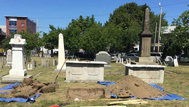
Tomb Maintenance in Eastern Cemetery, photo by Joe Dumais
Spirits Alive volunteers have been edging around the tombs for a couple of years to reveal the borders and markers that have been partially covered by sod. This helps us understand where the boundaries of tombs areas are and where to walk within the section.
Archives
Photographs
There is a complete set of over 300 photographs cataloging different views of the tomb markers on our Section A Tombs album on Flickr. Images were taken of all markers at each plot (or just the plot if there is no marker visible), and they are titled to include the tomb number (example: atomb24monumentsouth) that corresponds to the burial records book and 1890 Plan of Eastern Cemetery map.
Updated Tomb Information and Listing of the Interred
Ron Romano wrote a paper on the tombs and discussed how members were moved from cemetery to cemetery in The Tombs: A 2017 update to the 1978 “Record of Interments” with new historical notes. He also lists the names of every formerly living person’s remains that has been memorialized, interred, removed, or added to every tomb, by plot number, in his appendices.
Underground Tomb Data Tables
Using the photo archive and information from paper transcription forms developed during our Stone Survey, Spirits Alive has created a set of tables presenting data about each of the marker stones in the Section A tombs area. Tables include characteristics such as missing obelisk toppers and transcriptions of tombstones. Plot numbers correspond to the 1890 Plan of Eastern Cemetery map.
We still need to finalize transcriptions of each marker. Contact us if you’re interested in finishing this project. It would mean spending time in Section A reading markers to confirm or add to the existing transcription.
References
1 Trinkley M, Hacker D. Master Plan for Eastern Cemetery, City of Portland, Maine. Chicora Foundation. March 1, 2011. back to text 1
2 Romano, Ron. The Tombs: A 2017 update to the 1978 “Record of Interments” with new historical notes. Fourth in a series of occasional papers about Eastern Cemetery, Portland Maine, 2017. back to text 2
Please email us if you see errors on this page or any page of this website. Thank you!